2019
2018
Monitoring biodiversity and land cover through remote sensors (Spanish)
In this talk, I shared some of the work of the DGPI team in CONABIO: automatic land cover monitoring based on satelite images and biodiversity monitoring through camera traps and audio recordings.
Multilevel models for the quick-counts 2018 (Spanish)
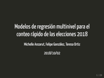
We developed multilevel regression models to estimate the election results based on a random sample of polling stations. The presentation consists on presenting the the prposed models, the methodology for model evaluation (including calibration results) and the performance on the election night.
Data Exploration with the tidyverse (Spanish)
A quick introduction to R with the tidyverse, hands-on talk with attendees running code.
R-Ladies CDMX Community Experience (Spanish)
R-Ladies' experience building community, the challenges we faced and the support we received.
Role Models (Spanish)
A talk for high-school girls undertaking a programming course, I describe my experience, including challenges and collaboration in …
Graphical Inference (Spanish)
An overview of graphical inference and examples in R
2017
Data Analysis for Social Development (Spanish)
In this expert pane event we discussed the new project from CAD Salud on Data for Healthy municipalities.


